Populations have always been susceptible to extreme events. While the occurrence of these events generally cannot be prevented, the risks can often be minimised and the impacts on affected communities and property reduced. For people and communities, the capacity to cope with, adapt to, learn from and, where needed, transform behaviour and social structures in response to an event and its aftermath all reduce the effects of a disaster (Maguire & Cartwright 2008). This can broadly be considered as resilience. Improving resilience at various scales and reducing the effects of natural hazards has become a key goal of governments, organisations and communities.
In 2010, the Council of Australian Governments adopted resilience as one of its key guiding principles. The National Strategy for Disaster Resilience (Attorney-General’s Department 2011) outlines how Australia should improve social and community resilience with the view that resilient communities are in a much better position to withstand adversity and to recover more quickly from extreme events. The Sendai Framework for Disaster Risk Reduction (UNISDR 2015) also uses resilience as a key concept and similarly calls for a people-centred, multi-hazard, multi-sectoral approach to disaster risk reduction. While there are obvious benefits from a resilience approach, a distinct need arises to be able to assess and monitor a community’s ability to prevent, prepare, respond to and recover from disasters.
In recognition of this need for assessment numerous tools have been developed (e.g. Shaw, Tackeuchi & Jonas 2010, Cutter et al. 2010, Arbon et al. 2012, Cohen et al. 2013, Sands 2015, Khalili et al. 2015). Approaches and scales vary from a top-down assessment method of community resilience across a whole country (e.g. Cutter, Burton & Emrich 2010) through to participatory local-level workshops (e.g. Arbon et al. 2012). Top-down assessments over a large area provide a standardised measure for comparison between communities. Theoretically this provides a knowledge base and justifiable system for decision-making in regard to planning and resource allocation by organisations such as state-based emergency services and state and federal governments. In addition, these consider resilience factors that occur at larger scales such as the spatial dependencies between places, communities and regions (Cutter et al. 2008, Frazier et al. 2013).
Alternatively, community-based assessments generally use a workshop approach with key community leaders and stakeholders. Often relying on subjective local knowledge makes comparison between communities difficult. However, they have an increased capacity for analysing and assessing greater levels of local knowledge, cultural practices and divergent interests or values within a community (Eriksen & Brown 2011, Singh-Peterson, Salmon & Goode 2015). By emphasising the role of local communities, this process can increase community engagement, risk awareness and resilience-thinking as well as help provide more informed local-level decision-making. It is primarily their capacity for facilitating local social learning and change that community-based approaches have been widely promoted (Singh-Peterson, Salmon & Goode 2015).
The Community Disaster Resilience Scorecard was developed by the Torrens Resilience Institute (Arbon et al. 2012, Arbon 2014) as a tool to identify and assess community resilience to disasters and extreme events. The suggested methodology is to use a number of workshops with key community members to assess and discuss resilience factors leading to a framework for future action.
The Scorecard has four main sections or components that are represented by the overarching questions:
Each section contains four to seven questions that are either answered via self-assessment or from information sources such as Australian census data. A scoring system for each question uses points ranging from a low of one through to a maximum of five. Each question’s points are then combined cumulatively to produce a score for the section. A rating is then allocated by converting this score to a percentage of the possible maximum for the section as follows:
The same percentage scale is used with the sum of the sectional scores to provide a single overall rating for the community’s state of disaster resilience. Descriptions range from ‘likely to suffer greatly in a disaster or have great difficulty recovering’ through to ‘extremely resilient’ (Arbon et al. 2012, Arbon 2014).
The Resilience Scorecard was piloted in four Australian communities (Arbon et al. 2012) and was subsequently used to examine resilience in coastal south-east Queensland (Singh-Peterson, Salmon & Goode 2015) and rural Victoria (Mason et al. 2016). This paper adds to this sample by providing an assessment of two Northern Territory remote indigenous communities and examines the Scorecard’s viability to assess resilience in these areas.
The Ngukurr community is located approximately 300 km south-east of Katherine on the Roper River, 70 km inland from the Gulf of Carpentaria in the Northern Territory. The area’s population of 1056 people (ABS 2011) is predominately indigenous. They collectively refer to themselves as Yugul Mangi people, a collective term meaning ‘we all one’. The area has a rich history with evidence of habitation by Aboriginal groups for more than 40 000 years. There are currently seven traditional language groups plus English and Kriol (Bird et al. 2013).
Gunbalanya (historically referred to as Oenpelli) is an Aboriginal community in west Arnhem Land located approximately 300 km east of Darwin. Gunbalanya is a similar size and dynamic to Ngukurr. Its population is approximately 1200 and the main languages spoken are Kunwinjku, Burarra and Kriol. Both communities are considered significant townships in Arnhem Land. They have a school, health services, supermarket, police station, sports club and community arts centre.
During the November to April annual wet season, the respective local river systems swell beyond capacity. Flooding causes both communities to become isolated for up to three months. Accessibility during these periods is restricted to infrequent barge services and the use of light aircraft on a charter basis.
Both communities are subject to the Northern Territory All Hazards Emergency Management Arrangements (NTES 2011) under which the responsibility for disaster preparedness, response and recovery planning is conducted by a Local Counter Disaster Planning Committee. A key task of the committee is to develop and maintain a Local Counter Disaster Plan that is approved by the Northern Territory Counter Disaster Council. The plans provide an assessment of the threats most likely to affect the community as well as the roles and responsibilities of agencies, stakeholders and key personnel. Location-specific control and coordination arrangements are provided with specific emergency response and recovery procedures (NTES 2011).
The scorecard system uses a number of information sources including self-assessment, census data and various government planning documents. The optimal process described involves meeting with a representative working group of 10 to 15 people three times over a four to six week period (Arbon et al. 2012). This method was not achievable in this case study due to the remoteness of the towns and the availability of staff and community members.
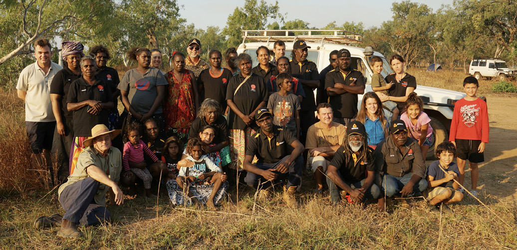
Instead, as part of a separate research project focusing on resilience issues in indigenous communities, 14 residents of each town, including elders, attended a three-day resilience workshop in the Ngukurr area in June 2015. A number of these people have been engaged as either local researchers or as participants in various resilience projects that included interviewing over 200 residents about resilience issues (Sangha et al. 2016). With the strong understanding of the aspects of disaster resilience within their communities, a scorecard-based resilience assessment for the two communities was undertaken. The self-assessment questions were answered by participants with direct questioning or through discussion of various resilience issues. Scoring of questions based on external data occurred after the workshop although most of the issues had been discussed with participants.
Overall, the findings (see Table 1) show that both communities were within the scorecard’s ‘caution’ zone meaning that considerable work is warranted to identify strategies and build disaster resilience. The scoring of self-assessment questions throughout the process was generally the same for both communities.
| Question / Indicator | Gunbalanya | Ngukurr | |
|---|---|---|---|
|
Score (1 Low - 5 High) |
|||
|
1. How connected are the members of your community? |
|||
|
1.1 What proportion of your population is engaged with organisations? |
1 |
1 |
|
|
1.2 Do community members have access to a range of communication systems that allow information to flow during an emergency? |
2 |
2 |
|
|
1.3 What is the level of communication between the local governing body and the population? |
1 |
1 |
|
|
1.4 What is the relationship of your community with the larger region? |
2 |
2 |
|
|
1.5 What is the degree of connectedness across community groups? |
2 |
2 |
|
|
Section 1 Score/Rating |
8 (Red) |
8 (Red) |
|
|
2. What is the level of risk and vulnerability in your community? |
|||
|
2.1 What are the known risks of identified hazards in your community? |
3 |
3 |
|
|
2.2 What are the trends in relative size of the resident population and the daily population? |
5 |
5 |
|
|
2.3 What is the rate of the population change in the last 5 years? |
4 |
3 |
|
|
2.4 What proportion of the population has the capacity to independently move to safety? |
2 |
2 |
|
|
2.5 What proportion of the resident population prefers communication in a language other than English? |
1 |
1 |
|
|
2.6 Has the transient population been included in planning? |
1 |
1 |
|
|
2.7 What is the risk that your community could be isolated? |
1 |
1 |
|
|
Section 2 Score/Rating |
17 (Caution) |
16 (Caution) |
|
|
3. What procedures support community disaster planning, response and recovery? |
|||
|
3.1 To what extent and level are households within the community engaged in planning for disaster response and recovery? |
1 |
1 |
|
|
3.2 Are there planned activities to reach the entire community about all-hazards resilience? |
1 |
1 |
|
|
3.3 Does the community actually meet requirements for disaster readiness? |
1 |
1 |
|
|
3.4 Do post-disaster event assessments change expectations or plans? |
1 |
1 |
|
|
Section 3 Score/Rating |
4 (Red) |
4 (Red) |
|
|
4. What emergency planning, response and recovery resources are available in your community? |
|||
|
4.1 How comprehensive is the local infrastructure emergency protection plan? |
3 |
3 |
|
|
4.2 What proportion of population with useful skills emergency response/recovery can be mobilised? |
1 |
1 |
|
|
4.3 To what extent are all educational institutions engaged in emergency preparedness education? |
1 |
1 |
|
|
4.4 How are available medical and public health services included in emergency planning? |
3 |
3 |
|
|
4.5 Are readily accessible locations available as evacuation or recovery centres and included in resilience strategy? |
2 |
2 |
|
|
4.6 What is the level of food/water/fuel readily availability in the community? |
2 |
2 |
|
|
Section 4 Score/Rating |
12 (Caution) |
12 (Caution) |
|
|
TOTAL |
41 (Caution) |
40 (Caution) |
|
The importance of both formal and informal communication networks was widely recognised as was the role of community connectedness in enhancing disaster resilience. As found by Singh-Peterson and colleagues (2015) there were a number of alignment issues between the information received, how that was represented by the actual indicators and by the scoring system. For example Question 1.1 uses census information as an indicator for connectedness. Both communities scored 1 in this instance. In a small isolated town the capacity to maintain a variety of community-based organisations is relatively small and a low response would be expected. In many cases such as with local sporting teams, while official membership may be quite low they may still receive considerable community support. In small rural communities of high familiarity extensive social interactions often occur such as when shopping in the town store. Similarly, as connections occur on numerous levels and in different ways including for ceremony, religion, sport, art and cultural festivals, many such interactions would not be recognised within the census data. While there is wide agreement that familial connections are weakening, especially for young people, indigenous culture still has strong kinship connections with extended families in regular contact and often living together.
Both communities have access to communication systems including digital television, regional radio stations, landline and mobile phone networks. While there are suitable systems in place, participants specifically discussed the lack of communication and location-specific information, including local weather warnings in the lead-up to and during extreme events. This would be due to the small size of both towns in reasonably isolated environments that would limit the level of media interest and the amount of location-specific information available.
The scoring for governance uses a measure based on the International Association for Public Participation Spectrum (2005) that ranges from ‘passive’ to ‘active’ participation. The issue of governance was strongly discussed and participants clearly felt that their role was extremely passive including in emergency management where direction and support came from Darwin in a non-consultative, fly-in-fly-out manner. This approach often did not respect cultural protocols such as those found by Gray (2006) and Veland and colleagues (2010).
Government agencies and organisations such as medical centres are part of, or have, networks within the region. In the past, ties of kinship and ceremony built strong relationships over a larger area but, due to a range of factors, these networks are not as strong as they were. For many people the isolation due to flooding, lack of transport and distance reduces their capacity to be regularly involved in a larger regional setting. Locally there is some advertising, primarily on community noticeboards, of various activities and events within the area.
Overall, both communities scored 8 out of a possible 25 for the section. That rates both as ‘red’. While this reflects the connectedness of the community in a broader context of information flows and government interaction, it does not reflect the connectedness between residents at the local scale.
Overall, this section attracted a ‘caution’ rating with scores at both extremes. Local risks were well known and although cyclones dominated, risk from fire and smoke were also discussed. On the Scorecard, the recognition of multiple risks would generate a higher score but existing maps only cover flooding and, hence, a score of 3 was allocated.
While a significant factor of resilience for some areas, the difference between daily and resident populations in a small town is often negligible. In this case study, both towns scored 5. Conversely both towns scored 1 for the incorporation of transient populations in planning. As the number of people within this category is negligible it was not seen as problematic.
Census data was used to determine the capacity of residents to independently move to safety (see Question 2.4). Only 2.5 per cent of the population of each town indicated they required assistance for core activities (self-care, body movements or communication). However, in terms of evacuating out of town the ‘number of motor vehicles per dwelling’ indicates that 50 per cent of homes in Ngukurr and 55 per cent in Gunbalanya do not a have a motor vehicle (ABS 2011). The ‘number of persons usually resident’ figure shows that for Ngukurr 74 of 121 (60 per cent) and in Gunbalanya 83 of 150 (55 per cent) of homes have six or more people. Subtracting the number of people in smaller households from the overall population shows an average of around 12 people per house for larger households (confirmed by participants). While a precise figure is not calculated, a proportion of households without a vehicle would coincide with these large households. Therefore, the capacity to self-evacuate by vehicle would be considerably less than half the residents of each town. Further, both towns are isolated by road for a few months each year and evacuation may only be possible by light aircraft, which can be problematic due to cultural considerations (Veland, Howett & Dominey-Howes 2010). While relatively few people require core assistance, the reduced capacity to evacuate from each town derives a score of 1. The same score was allocated to Question 2.7 that considers the possibility of isolation.
For many people in predominately indigenous communities, English is only one of the languages spoken. Around 90 per cent of residents do not normally speak English at home (ABS 2011). The scorecard method considers more than 35 per cent to be a rating of 1. In this case study communication levels were high and the level of English is still good, but there is a possible disjunction between residents and any English-only speaking authorities.
Question 2.3 examines population change. Both communities received scores that were moderate to good. In this instance, Gunbalanya scored 4 (6-12 per cent) as opposed to Ngukurr’s score of 3 (13-19 per cent), which although slightly higher, does not affect the rating for the section.
This section highlighted numerous issues with each community scoring the lowest possible for each question. Planning for emergency situations at a household level was felt to be very limited due to other urgent priorities such as food availability, housing and family concerns. While there is a Local Counter Disaster Management Plan, few participants had seen it. It was mentioned that the plan was held at the local police station and if residents knew of it and were inclined to read it, many would not be comfortable doing so.
Many participants did not know that the local school was a designated public shelter. Local cultural protocols, norms and practices affect how these facilities are used during a natural hazard event. This was noted during Cyclone Monica (Veland, Howett & Dominey-Howes 2010). Participants discussed that although some buildings were marked as cyclone-proof other buildings that residents thought should be marked were not.
While there are a number of plans, procedures and structures in place, the assessment by residents for these actually meeting requirements for disaster readiness would be classed as an unknown and, thus, scored a 1. Similarly any post-event assessments from past emergency situations had not involved the local population and had not affected expectations.
A discrepancy occurred between the responses of workshop participants and those of a household survey. The survey responses showed a higher level of knowledge of current planning and shelter options. This may be due to participant selection or participants not speaking up during this part of the discussion.
Planning at a government and infrastructure-supply level uses a top-down, command-and-control approach and incorporates multiple hazards and structures. For example, local power supply in both towns is managed by the Northern Territory Power and Water Corporation that has identified risks and contingencies for both locations. Participants discussed that emergency management was conducted by the local police and by others on a fly-in-fly-out basis from Darwin. From both sources communication about the situation and consideration of cultural norms was considered poor. It was felt strongly that although local people, knowledge and skills were available, including a number of people willing to be trained, these resources were not used. However, Gunbalanya has a volunteer emergency services unit with six members and Ngukurr is listed on the Northern Territory Emergency Service website (2016) as having an ‘Emergency response group’ described as ‘a group of organised volunteers with no formalised training’.
The Northern Territory Department of Health and the local medical clinics have emergency management plans that incorporate the broader region. However, when considering the size of the facilities and issues of accessibility there is an understandable limit to the capacity of available services. Given the size of both towns the local school is possibly the only evacuation and recovery centre. When the communities are isolated the level of food, water and fuel is generally adequate. However, food stores are often very low and a significant proportion of households could be classified as having daily or near-daily dependence on external supplies including, in some cases, locally obtained ‘bush tucker’.
In total, Ngukurr scored 40 and Gunbalanya scored 41 out of a possible 110 points. This gives both communities a rating of ‘caution’. However, the scoring is unbalanced within some sections and a few questions poorly represent the situation.
The objective of this study was to assess the state of resilience in two small remote predominantly indigenous communities in northern Australia, as well as to determine the applicability of the Torrens Scorecard approach for these communities. Despite the inclusion of elders and a number of participants having previously been involved in disaster resilience activities in their area, the level of knowledge of local plans and procedures was limited. This highlights the importance of involving key participants. It must be noted that levels of poverty and social issues within each community are high and while participants were keen and discussed possible improvements, disaster resilience is understandably not a priority under the prevailing circumstances.
While it appears that many procedures are in place across a range of spatial scales from local through to Territory-wide, the level of communication to the population is very limited and non-consultative. There is a strong disconnection between the primarily Indigenous residents and people in positions of authority in both towns. This was highlighted in multiple discussions and is an issue found in numerous indigenous communities (see Gray 2006, Veland, Howett & Dominey-Howes 2010, Howitt, Havnen & Veland 2012, Veland et al. 2013). In this instance it was particularly shown by the fact that post-event assessments from past emergency situations had not included the local population and that, even with repeat invitations to take part in this workshop, most relevant officials did not respond and none were able to attend.
As also found by Singh-Peterson and colleagues (2015), there were issues of determining and accessing data as well as a number of questions not entirely relevant nor suited to small communities. Although both towns had a low score and significant issues in regard to disaster resilience, what was not represented were those differences attributable to the community’s small size, self-reliance and the cultural background of the population. With little or no expectation of assistance from authorities the reliance is on one’s self, friends and family. Under the predominate culture with these towns, this ‘self’-reliance incorporates a large kinship network and translates into a community that informally appears to have a reasonable ability to cope with stress. However, with the small size and low socio-economic status of the population, recovery from abnormal situations can be anticipated to be slow and only to a very poor level that in other areas would be deemed unacceptable (as reported in Veland et al. 2013).
The scorecard method provides a rating system to connect a level of description and understanding to a numerical value. However the ‘caution’ rating ranges from a score of 34 to 98 and the potential difference between communities within this range belies the rating’s value. Similarly, based on this rating method and the underlying scoring matrix, it appears unlikely that any community in Australia would be considered to be in the ‘red zone’ for overall scoring. However, there is no doubt that the scorecard method did provide excellent discussion points on numerous emergency management and societal issues as well as provide a reminder of topics that may be missed in an unstructured setting. Similarly, even when used with the changes and limitations involved in this study, it did identify a range of very significant issues that, if addressed, would greatly improve the resilience of these communities.
This research is supported by funding from the Bushfire and Natural Hazards CRC.
Arbon P, Gebbie K, Cusack L, Perera S & Verdonk S 2012, Developing a model and tool to measure community disaster resilience. Community Disaster Resilience Scorecard Toolkit.
Arbon P 2014, Developing a model and tool to measure community disaster resilience, Australian Journal of Emergency Management, vol. 29, no. 4, pp. 12-16. At: ajem.infoservices.com.au/items/AJEM-29-04-04.
Attorney-General’s Department 2011, National Strategy for Disaster Resilience, Attorney-General’s Department, Canberra.
Australian Bureau of Statistics 2011, Census of Population and Housing, Basic Community Profile.
Bird D, Govan J, Murphy H, Harwood S, Haynes K, Carson D, Russell S, King D, Wensing E, Tsakissiris S & Larkin S 2013, Future change in ancient worlds: Indigenous adaptation in northern Australia, National Climate Change Adaptation Research Facility, Gold Coast, pp. 257.
Cohen O, Leykin D, Lahad M, Goldberg A, & Aharonson-Daniel L 2013, The conjoint community resiliency assessment measure as a baseline for profiling and predicting community resilience for emergencies. Technological Forecasting and Social Change.
Cutter S, Barnes L, Berry M, Burton C, Evans E, Tate E & Webb J 2008, A place-based model for understanding community resilience to natural disasters. Global Environmental Change, vol. 18, no. 4, pp. 598-606.
Cutter S, Burton C, Emrich C 2010, Disaster Resilience Indicators for Benchmarking Baseline Conditions. Journal of Homeland Security and Emergency Management, vol. 7, p. 1.
Eriksen S & Brown K 2011, Sustainable adaptation to climate change, Journal of Climate and Development, vol. 3, no. 1, pp. 3-6.
Frazier T, Thompson CM, Dezzani RJ & Butsick D 2013, Spatial and temporal quantification of resilience at the community scale, Applied Geography, 424, pp. 95–107.
Gray B 2006, Council of Australian Governments Trial Evaluation Wadeye, Northern Territory: an independent evaluation. WJG & Associates, Canberra.
Howitt R, Havnen O & Veland S 2012, Natural and Unnatural Disasters: Responding with Respect for Indigenous Rights and Knowledges. Geographical Research, vol. 50, pp. 47-59.
International Association for Public Participation 2005, Public Participation Spectrum. At: iapt2.org.
Khalili S, Harre M & Morley P 2015, A temporal framework of social resilience indicators of communities to flood, case studies: Wagga Wagga and Kempsey, NSW, Australia, International Journal of Disaster Risk Reduction, vol 13, pp. 245-256
Mason A, Crofts E, Steenkamp M & Ramsey I 2016, Developing ‘Emergency Ready Communities’: a tale of two Victorian councils. Australian Journal of Emergency Management, vol. 31, no. 3, pp. 27-32. At: ajem.infoservices.com.au/items/AJEM-31-03-13.
Maguire B & Cartwright S 2008, Assessing a community’s capacity to manage change: A resilience approach to social assessment. Bureau of Rural Sciences, Canberra.
Northern Territory Emergency Service 2011, Northern Territory All Hazards Emergency Management Arrangements. At: www.pfes.nt.gov.au/resources/ntes/cda/docs/All_Hazards_Emergency_Management_Arrangements.pdf [January 2016].
Northern Territory Emergency Service 2016, Emergency response groups, www.pfes.nt.gov.au/Emergency-Service/Your-local-volunteers/Volunteer-location-profiles/Emergency-response-groups.aspx [January 2016].
Sands D 2015, Innovative Scorecard for Evaluating Resiliency in our Cities, GRF Davos Planet@Risk, vol. 3, no. 1, Special Issue on the 5th IDRC Davos 2014, March 2015.
Sangha K, Sithole B, Hunter-Xenie H, Daniels C, Yibarbuk D, James G, Michael C, Gould J, Edwards A, & Russell-Smith J 2016, Empowering the resilience of remote Indigenous communities in northern Australia. International Journal of Mass Emergencies and Disasters (in press).
Shaw R, Takeuchi Y & Jonas J 2010, India City Profile: Climate and Disaster Resilience Consultation Report At: www.preventionweb.net/english/professional/publications/v.php?id=15263%20 [January 2016].
Singh-Peterson L, Salmon P & Goode N 2015, An assessment of community disaster resilience for small, high-risk communities on the Sunshine Coast. Australian Journal of Emergency Management, vol. 30, no. 1, pp. 35-40. At: ajem.infoservices.com.au/items/AJEM-30-01-11.
United Nations International Strategy for Disaster Reduction (UNISDR) 2015, Sendai framework for disaster risk reduction 2015–2030. Geneva: UNISDR.
Veland S, Howitt R & Dominey-Howes D 2010, Invisible institutions in emergencies: Evacuating the remote Indigenous community of Warruwi, Northern Territory Australia, from Cyclone Monica. Environmental Hazards: Human and Policy Dimensions, vol. 9, pp. 197-214.
Veland S, Howitt R, Dominey-Howes D, Thomalla F & Houston D 2013, Procedural vulnerability: Understanding environmental change in a remote indigenous community. Global Environmental Change, vol. 23, pp. 314-326.
Philip Morley, Institute for Rural Futures, University of New England.
Jeremy Russell-Smith, Darwin Centre for Bushfire Research, Research Institute for Environment & Livelihoods, Charles Darwin University.
Kamaljit K. Sangha, Darwin Centre for Bushfire Research, Research Institute for Environment & Livelihoods, Charles Darwin University.
Bev Sithole, Aboriginal Research Practitioners Network (ARPNet), Research Institute for the Environment and Livelihoods, Charles Darwin University.
Stephen Sutton, Darwin Centre for Bushfire Research, Research Institute for Environment & Livelihoods, Charles Darwin University.

