By Mischa Hill, Emergency Management Advisor, Wellington Region Emergency Management Office
This year marks the 85th anniversary of one of the worst disasters in New Zealand’s history.
On 3 February 1931, a magnitude 7.8 earthquake occurred in the Hawke’s Bay region of New Zealand, causing extensive damage to much of Napier city and Hastings (The Daily Telegraph 1931, Dowrick 1998). The total death toll was 256 and much of Napier’s CBD was destroyed by fires that began within minutes of the earthquake and rapidly swept through the city (Callaghan 1933, Thomas et al. 2006).
This event caused the largest loss of life and most extensive damage of any quake in New Zealand’s history. However, behind this tragedy is a remarkable recovery story. The Hawke’s Bay we see today is a reflection of a host of key decisions and strategies in the reconstruction following the 1931 event.

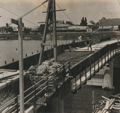
Image: Smith, R Trevor, Alexander Turnbull Library, Wellington, New Zealand.
Wairoa River Bridge, Wairoa, Hawke’s Bay, under repair after the 1931 Hawke’s Bay earthquake.
The recovery process following the Hawke’s Bay earthquake was one of the first large-scale examples (in New Zealand) of embedding techniques to reduce the risk of future disaster in the reconstruction of a city. These activities were underpinned by three key strategies:
Response activities persisted for a month after the earthquake hit and were facilitated by the creation of the Napier Citizens Control Committee. ‘The methods adopted were to co-operate both local residents and outside experts and workers.’ (The Daily Telegraph 1931, p. 91).
The committee was later superseded by the Napier Reconstruction Committee, led by two commissioners, to facilitate the permanent reconstruction. The committee comprised of local architects, lawyers, planners and businesses (The Daily Telegraph 1931, Conly 1980, Annabell 2012). Interestingly, even 80 years ago, Napier was following what is now thought of as international best practice—a city that paid attention to long-term recovery in the immediate days following the disaster, and to a process where locals were an active part of the long-term recovery.
Many architectural, engineering and infrastructure solutions were considered after the event to reduce the risk of further disasters. Some of these included widening streets and restricting the height of buildings within the CBD, splaying of building corners, abandoning cornices, regulating the construction of verandas and placing lifelines underground (Annabell 2012, Campbell 1975, Conly 1980, McGregor 1998). Many more initiatives were explored but due to the earthquake occurring in the great depression, funds were limited (Chapple 1997). There was also a balance in play with ensuring that ‘every citizen was to get his business going again as soon as possible’ (Barton 1932, p. 73).
The reconstruction of Napier, not only contributed to disaster risk reduction at a local level, but also at the national level. The disaster was a catalyst for some key national legislation: a national building code by-law, a Town and Planning Act giving jurisdiction to local authorities to implement regulations on design standards, and a nationwide insurance scheme that covered all New Zealanders (most people did not have insurance at the time) (O’Riordan 1971, Britton 1981, New Zealand Standard Institution 1935, Childs 1972).

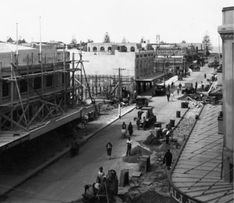
Image: Sorrell, Percy, Evening Post, 1865-2002Alexander Turnbull Library, Wellington, New Zealand.
Men working on the road and buildings in Emerson Street, Napier, after the earthquake of 1931.
For those in Hawke’s Bay, this year is a time to remember those who lost their lives, their family and friends in the disaster. It is also a time for New Zealand to reflect on the lessons the Napier event taught. This event changed the future for New Zealand and paved a way for how disaster risk reduction can be successfully implemented post-disaster as a balance of continuity and change.

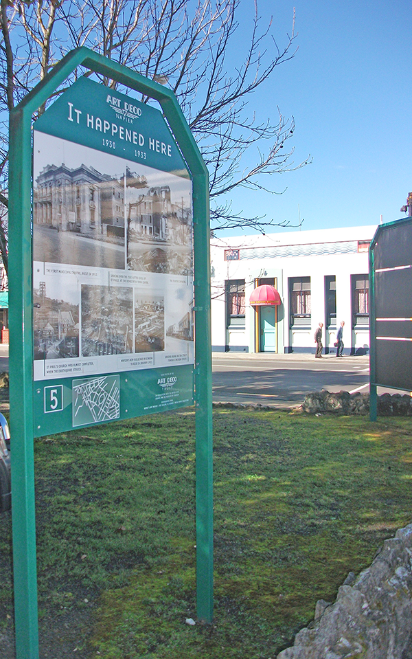
Image: Mischa Hall
One of many memorial boards scattered throughout Napier City to commemorate the earthquake.
Annabell JB 2012, Planning Napier 1850-1968. PhD thesis, Massey University, Manawatu.
Barton JS 1932, The re-planning of Napier. Community Planning 2, pp. 73-8.
Britton NR 1981, What have New Zealanders learnt from earthquake disasters in their own country? Disasters 5, pp. 384-90.
Callaghan FR 1933, The Hawke’s Bay earthquake: general description. The New Zealand Journal of Science and Technology 15, pp. 1-37.
Campbell MDN 1975, Story of Napier: Footprints along the Shore. Napier City Council, Napier.
Chapple S 1997, The Economic Effects of the 1931 Hawke’s Bay Earthquake. Working paper 97/7, New Zealand Institute of Economic Research, Wellington.
Childs JB 1972, A town planning case study: Napier since the earthquake. Diploma in Town Planning Dissertation, The University of Auckland, Auckland.
Conly G 1980, The Shock of 31: The Hawke’s Bay Earthquake. AH & AW Reed, Wellington.
Dowrick DJ 1998, Damage and intensities in the magnitude 7.8 1931 Hawke’s Bay, New Zealand, earthquake. Bulletin of the New Zealand Society for Earthquake Engineering 8, pp. 255-9.
McGregor R 1998, The Hawke’s Bay Earthquake: New Zealand’s Greatest Natural Disaster. Art Deco Trust, Napier.
New Zealand Standard Institution 1935, NZS No. 35: New Zealand Standard Model Building By-Law. New Zealand Standards Institution, Wellington.
O’Riordan T 1971, The New Zealand Earthquake and War Commission: a study of a national natural hazard insurance scheme. Natural Hazard Research Working Paper No 20, Natural Hazards Center, Boulder.
The Daily Telegraph 1931, Hawke’s Bay ‘Before’ and ‘After’ – The Great Earthquake of 1931: An Historical Record. The Daily Telegraph, Napier.
Thomas GC, Schmid R, Cousins WJ, Heron DW, Lukovic B 2006, Post-earthquake fire spread between buildings – Correlation with 1931 Napier earthquake. In Proceedings of the 2006 New Zealand Society for Earthquake Engineering Conference. New Zealand Society for Earthquake Engineering, Wellington. At: www.nzsee.org.nz/db/2006/Paper03.pdf [17 March 2016].